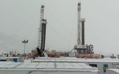
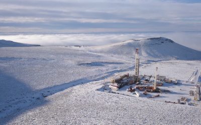
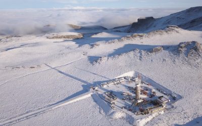
Previous Next SERVICIOS CONTROL GEOLÓGICO Ofrecemos detección contínua de gas total y Cromatografía de C1 a NC5 con equipos FID de alta sensibilidad y Cromatografías en 30 segundos. TRAILER LABORATORIO Todas nuestras unidades están preparadas técnicamente para prestar desde un servicio "Standard" hasta el servicio "On-Line". GEOQUÍMICA ON LINE Espectrometría de masas ON Line, pudiendo detectar con esta tecnología hasta 200 tipos de gases diferentes. TECNOLOGÍA DE CAPILAR Brindamos el servicio de tecnología de capilar (DUPLEX DSS22205-1/4"-3/8") con nuestras propias unidades de montaje de equipo. SLICK LINE Incorporamos este servicio para cubrir otra de las necesidades básicas a los pozos y que brinda soluciones con un reducido costo. GEOCONTROL S.R.L. 2 Videos Institucional Geocontrol SRL 1:29 12° Aniversario Geocontrol SRL 1:01 SOBRE NOSOTROS Somos una empresa de Neuquén creada en 2010 por profesionales con ardua experiencia en el control Geológico de pozos en todas las cuencas de la República Argentina. Durante nuestra trayectoria, la Empresa se ha consolidado en el mercado, habiendo diversificado sus servicios y clientes, apostando a la constante renovación tecnológica de Equipos Especiales. MÁS INFO SI SOS GEÓLOGO Y QUERÉS TRABAJAR EN GEOCONTROL, ENVIANOS TU CURRICULUM VITAE A ESTE MAIL. coordinacion@geocontrolsrl.com.ar GALERÍA Ingresá a nuestra galeria y conoce más sobre Geocontrol Previous Next MÁS FOTOS CONTACTANOS Nombre Email Mensaje Enviar